

Construction Progress Monitoring & Drone Documentation Greensboro
Visual Verification • Stakeholder Transparency • Reality Capture
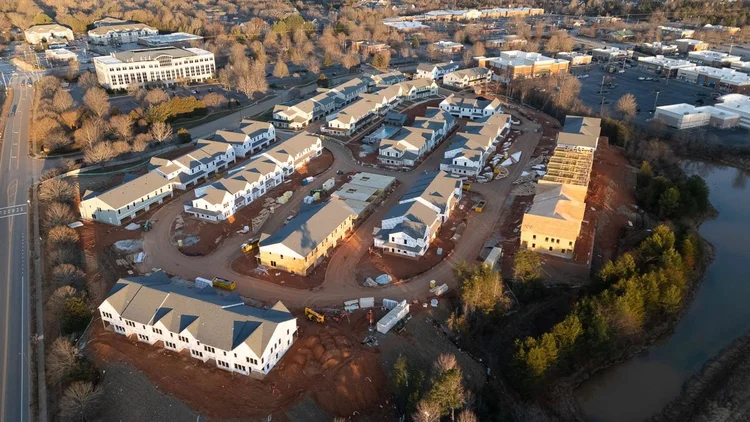
Don Evans Photography delivers high-resolution construction timelapse monitoring and repeatable visual documentation for Greensboro and Guilford County industrial developments.
Request Site Feasibility
Send Greensboro project details for a quick consult and custom documentation proposal.
$11,000 Liability Shield
FAA Part 107 Certified and $1M insured. We protect Greensboro stakeholders from the dual-liability $11,000 federal fines and safety risks associated with unlicensed drone operations.
Visual Stakeholder Transparency
Provide a defensible 4K visual record. Our repeatable drone missions and long-term passive timelapse allow remote stakeholders to verify Guilford County build milestones without site visits.
BIM-Ready Reality Capture
Beyond photography. We deliver high-fidelity visual assets designed to support BIM workflows and structural documentation for Greensboro industrial developments.
Reality Data Capture
- Repeatable Accuracy: Scheduled drone missions that capture site evolution with precision.
- Remote Site Transparency: Provide stakeholders with a "Truth" record without site visits.
- Defensible Documentation: Time-stamped proof to mitigate risks and resolve schedule disputes.
- BIM Support Visuals: High-resolution visual assets to support 3D modeling and BIM workflows.
Integrated Monitoring
- Passive Time-lapse: 4K long-term tracking for the full build lifecycle.
- Cloud Integration: Daily folder uploads for stakeholder review (WiFi dependent).
- Drone Progress Missions: Contextual aerial views of site-wide activity.
- Actionable Intelligence: Instant visual confirmation of task completion and staging.
Mission Certainty
- FAA Part 107 Certified: Professional aviation standards applied to every flight.
- Disciplined Workflows: Strict airspace coordination and safety protocols.
- Full Liability Coverage: Enterprise-grade $1M+ insurance for Greensboro industrial zones.
- Direct Access: One-on-one collaboration with the pilot for custom reporting.
Site Intelligence Tiers
Standard Progress Suite
(Drone Only Coverage)| Aerial Mission Bi-Weekly Visits | $500 /mo |
| Deliverables High-Res Stills | Included |
| Context 4K Perimeter Video | Included |
Integrated Site Intelligence
(Drone + Daily 4K Timelapse)| Workflow Single-Zone Capture* | $850 /mo |
| Hardware 4K Weatherproof Unit | Included |
| Data Sync Daily WiFi Uploads* | Included |
*Requires on-site WiFi access for remote sync.
Reserve Site BundleEnterprise Reality Capture
(Multi-Site & BIM Support)- Reality Assets for BIM Support
- Full Perimeter Timelapse Arrays
- Multi-Site Regional Contracts
What is "Passive Monitoring?"
A weather-sealed camera system deployed for Greensboro build tracking and stakeholder transparency.
How do you handle site safety?
I am a Part 107 Certified pilot. Drone monitoring eliminates manual high-altitude risk on the job site.
Can we request on-demand video?
Yes. Ground-level cinematic units complement aerial progress shots for Greensboro project milestones.
What region do you cover?
We provide professional Greensboro drone services throughout Guilford County and the Piedmont Triad.
Greensboro Project Consultation
Safety is our #1 priority. Read our guide on FAA Compliance and Drone Liability